

More Dolomites
Val Gardena and Four Mountain Passes


September 15, 2025
We woke up to a bright and sunny day and decided to try to see a different part of the Dolomite region. We got a late start and the traffic was more than we expected, so our phones said we would not reach our destination until somewhat after 10 am. We were concerned about parking availability (advice is typically to arrive by 9 a.m.), so we had two choices in our minds and crossed our fingers.
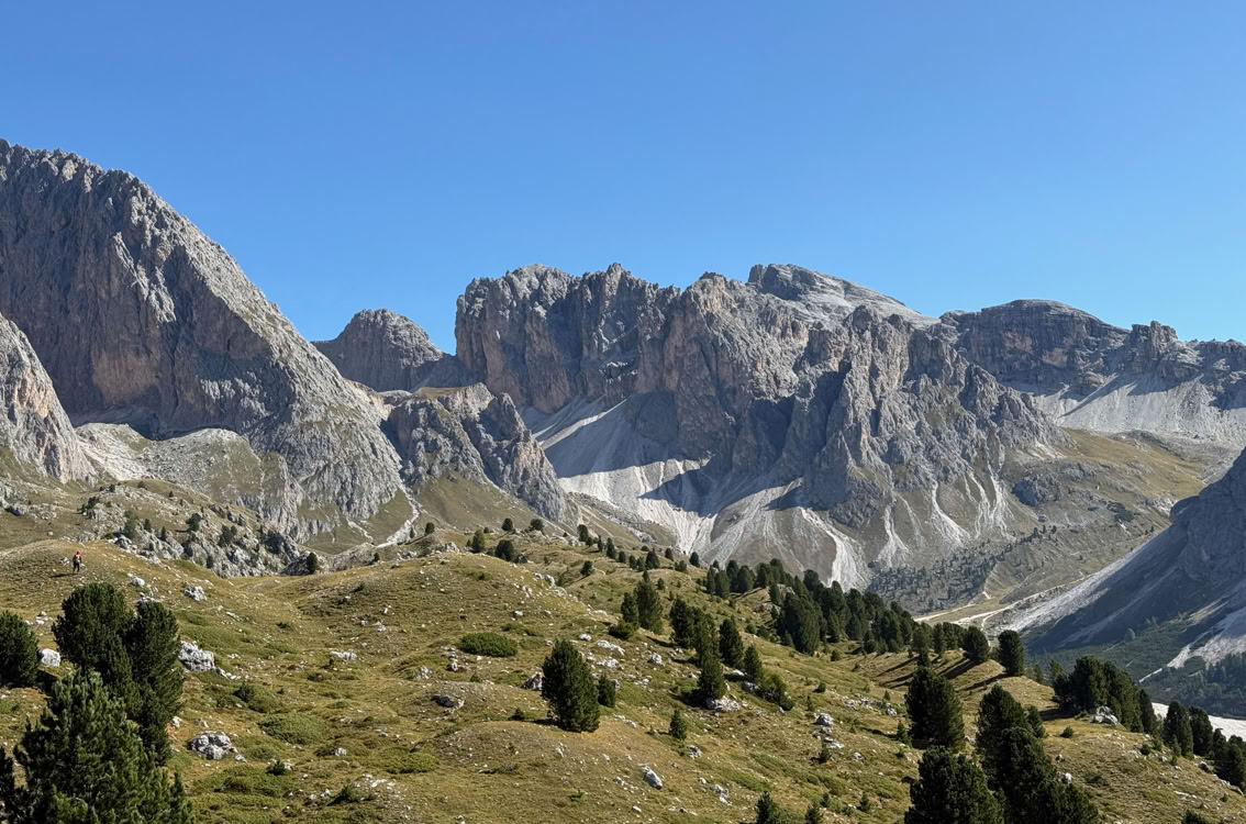
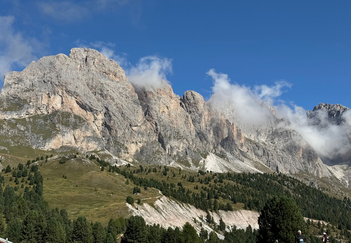
Along the drive to our destination, which is located in the Val Gardena, we went over the Gardena Pass at about 7,000 feet.


The above photos were taken on the drive to Santa Cristina in Val Gardena.
From there, we descended to the town of Santa Cristina, which we had visited once before (in the last century) at a time of year the lifts were not running. We were hoping to ride a lift this trip!
It turned out we were lucky and got a parking space at the base station for the Col Raiser cable car. Here’s the view from the ride up. The cars were similar to the last two lifts we took.

The ride to the upper station took 12 minutes and we were impressed with the view the minute we stepped out of the station. The elevation is about 6,800 feet. This is the view near the upper station.

From there, we took a walk to the UNESCO Dolomite viewing platform and climbed about 400 feet up to it. The views are 360 degrees around, including a nice view of the Sassolungo across the valley. The Seceda Massif is above and behind the platform.

This photo shows the balcony (and very tiny people on the trail going up). The version below has a red arrow to help
locate the balcony.


We couldn’t believe how beautiful it was! This was what we were hoping for on this, our third trip to the Dolomites. A few more photos.


Trip up, on left. We walked most of the way with this nice Italian couple (right).
Here’s a view from the balcony. Below that, a panorama shot.


Two more photos of the glorious views.
We took a slightly different (longer) path back down to the upper cable car station, where we had another wonderful outdoor lunch at a mountainside restaurant.
We descended to the base station from there. When we got back in our car, we decided to take a different route back to San Candido, passing over three mountain passes. The first pass was the Sella Pass, which offered views of the Sella Group, and we saw a cable car that appeared to hold only two passengers. Here are photos from the Sella Pass.


We continued our drive to the Pordoi Pass, elevation about 7,300 feet. We parked the car and got out to walk around a bit and were overwhelmed by the massive mountains above us. This pass has a larger cable car (more of a gondola) that looks to hold 40 or 50 people and goes all the way up to the top of the mountain. We didn’t have time to ride it today and hope to be back one day to give it a try.


This area included some of the most dramatic scenery of our trip. The Pordoi Pass is on the Great Dolomites Road, and we had driven it before, in 2000, on a drive from Trento to Cortina d’Ampezzo (the site of the 1956 and the 2026 winter Olympics). The pass marks the border between the provinces of Trento and Veneto. San Candido, where we are staying, is located in Alto Adige (South Tyrol), an autonomous and multi-lingual region of Italy.
Once we entered the Veneto, we drove down into a valley and then back up to reach our fourth mountain pass of the day, the Falzarego Pass. This area has a significant history from WWI since this was where battles were fought on the front lines between Austria and Italy.
Along the way, we had views of the Marmolada (the highest mountain the Dolomites at 11,000 feet, but of course not the highest in Italy because the country claims half of Mount Blanc) and the Tofana di Mezzo (almost as high), near Cortina. We drove through more amazing mountain scenery, through the town of Cortina, which was buzzing with construction for the upcoming 2026 Winter Olympics. Looks like they have their work cut out to finish in time for the opening!


These photos were taken near the last pass, getting close to Cortina.


We then drove north in the direction of our hotel and made one last stop. Along the road south of Dobbiacco, there is a great viewpoint to see the peaks of the Tre Cime from afar. We had originally had hoped to hike near them, but decided against it on this trip given the iffy weather. Here are some views of the Tre Cime.


And here is the Dolomites map again.
We returned to our hotel for our last night here, having enjoyed three and a half wonderful days in the Dolomites. It was a long day today (covering close to 200 km, almost 5 hours driving), but worthwhile to see some spectacular scenery.
Tomorrow we head back to Austria.
